Northern England in
the Quaternary period (2.6 Ma to the present) Part 1
|
By the end of the Tertiary Britain had moved north to about its present
latitude. It was during the Quaternary that a general lowering of world temperature
took place which heralded the beginning of a series of very cold to temperate
periods collectively known as the Ice Age during which we are living now.
During these last 2 million years ice sheets have repeatedly advanced over
large areas of North America and Northern Europe on at least four occasions.
Various estimates of the thickness of these ice sheets have been made, some
being up to one kilometre thick. Between glaciations the climate improved resulting in interglacial
periods. Our present climate is more than likely an interglacial one.
Glaciations, especially the last one which ended about 11,000 years ago, had
a profound influence on the landscape as we see it today. |
|
|
During the last glaciation, known as the Devensian,
Highland areas, such as the Lake District, Scottish Highlands, Southern
Uplands and the Cheviot Hills generated ice caps from which ice sheets and
glaciers travelled eroding huge amounts of material on their way. Hollows,
known as corries in mountain sides and U shaped valleys were produced by the
erosive power of ice. This material was redeposited across much of the
lowlands as far south as the Midlands. Most of Northern England up to about
1000ft. has a covering of boulder clay. The effects of the last
glaciation are not yet over; Scotland is still rising as it recovers from the
weight of ice, while much of England is sinking. |
|
|
At present about 10% of the earth's surface is covered by ice. Ice
forms on land when the temperature is low enough for snow to exist all year
round. When glacier ice moves over a land surface it erodes by plucking,
gouging and grinding. Plucking occurs when pieces of bedrock frozen in the
base of the ice and are plucked out when the glacier moves. Debris collected
by plucking provides the tools for grinding and gouging the rocks beneath.
Gouging by larger fragments can produce grooves in the underlying bedrock.
These grooves are known as glacial striations. Some material may be carried
on the surface of a glacier, usually frost shattered debris that has fallen
onto the ice from higher ground. |
|
|
It is the enormous erosive power of
glaciers that have produced the characteristic landscape seen in the Lake
District, such as the U shaped valleys and the corries and tarns at the heads
of the valleys where the ice accumulated. When two glaciated valleys are
adjacent to each other, a narrow steep sided ridge is produced known as an
arête, a classic example being Striding Edge in the Lake District. Many
glacial valleys have been flooded by lakes, e.g. Thirlmere. |
|
|
|
Left: Maps showing extent and direction of flow of ice during the
Anglian and Devensian glaciations. The Anglian Stage started about 478,000
years ago and ended about 424,000 years ago; i.e. it lasted for about 54,000
years. The Devensian Stage started about 110,000 years ago and ended about
11,000 years ago; i.e. it last for about 99,000 years. The Anglian was the most extreme glaciation during the last 2 million
years. Diagrams from: Britain before Man, by F.W.Dunning,I.F. Mercer,
M.P.Owen,R.H.Roberts and J.L.M. Lambert |
|
Glacial deposition. Sediment deposited by glaciers and ice sheets when they melt can vary
in size from large boulders to clay sized particles, hence glacial deposits
are known as boulder-clay or till. Dumping of material at the end, or snout,
of a glacier produces banks of terminal moraine. These are often a ridge or
series of ridges which are left during stages of glacier or ice sheet melting.
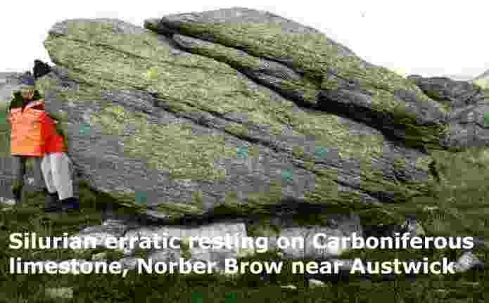
Some moraines may act as dams and cause lakes in some glacial valleys. Ice sheets and glaciers can transport material for large distances.
Distinctive rock types can help determine the direction in which the ice has
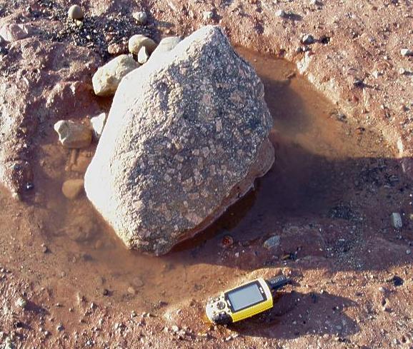
moved. A well known example is the distribution of
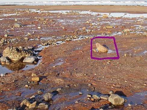
boulders of Shap Granite which comes from near Shap in the Lake District. Boulders of Shap Granite can be seen across Stainmore
and on the North Yorkshire coast, e.g. at Saltburn,
Sandsend and Runswick
Bay. Such rocks are known as glacial erratics. Other glacial features produced by deposition are drumlins which are
smooth, streamlined oval-shaped landforms, often blunt at one end and tapered
at the other. They may occur singly but are more commonly found in large
groups called drumlin fields or drumlin swarms. They are believed to be the
result of selective deposition of material which is then streamlined by the
advancing ice-sheet. Kames are steep-sided mounds of bedded sand and gravel. They are the result
of deposition by meltwater within gaps (crevasses) of stagnant ice. Marginal
slumping of kames often occurs when the stagnant ice melts. Kame terraces are
continuous valley-side land-forms resulting from deposition of material by
meltwater between the margin of the ice-sheet or glacier and the valley
side. |
|


