Northern England in the Tertiary period (65 to 2.6 Ma)
|
|
This period began with another major lowering of sea-level together
with uplift, and nearly all of Britain, apart from the south-east emerged as
land. Because of this, it is most likely that no Tertiary sediments were
deposited in Northern England, although thick sequences are known offshore
beneath the North sea. |
|||||||||
|
Uplift and the development of the constructive plate margin on the
western side of the British Isles were responsible for the general tilting of
Britain towards the south-east as well as the renewed activation of major
faults, e.g. those surrounding the Alston Block. |
|
|||||||||
|
Notice how the North Atlanric is beginning to be “dragged open” resulting in Tertiary volcanic activity and
intrusion of dykes. Map to the right from: Phanerozoic Polar Wander,
Palaeogeography and Dynamics Trond H. Torsvik , Rob Van
der Voo, Ulla Preeden
, Conall Mac Niocaill
, Bernhard Steinberger, Pavel V. Doubrovine, Douwe J.J. van Hinsbergen, Mathew Domeier
,Carmen Gaina, Eric Tohveri, Joseph G. Meert,
Phil J. A. McCausland, L. Robin M. Cocks |
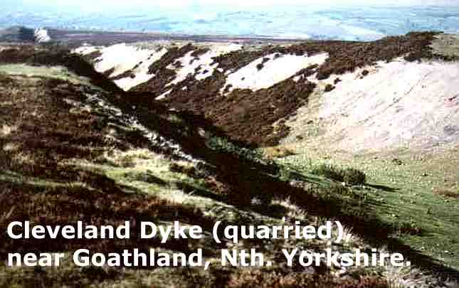
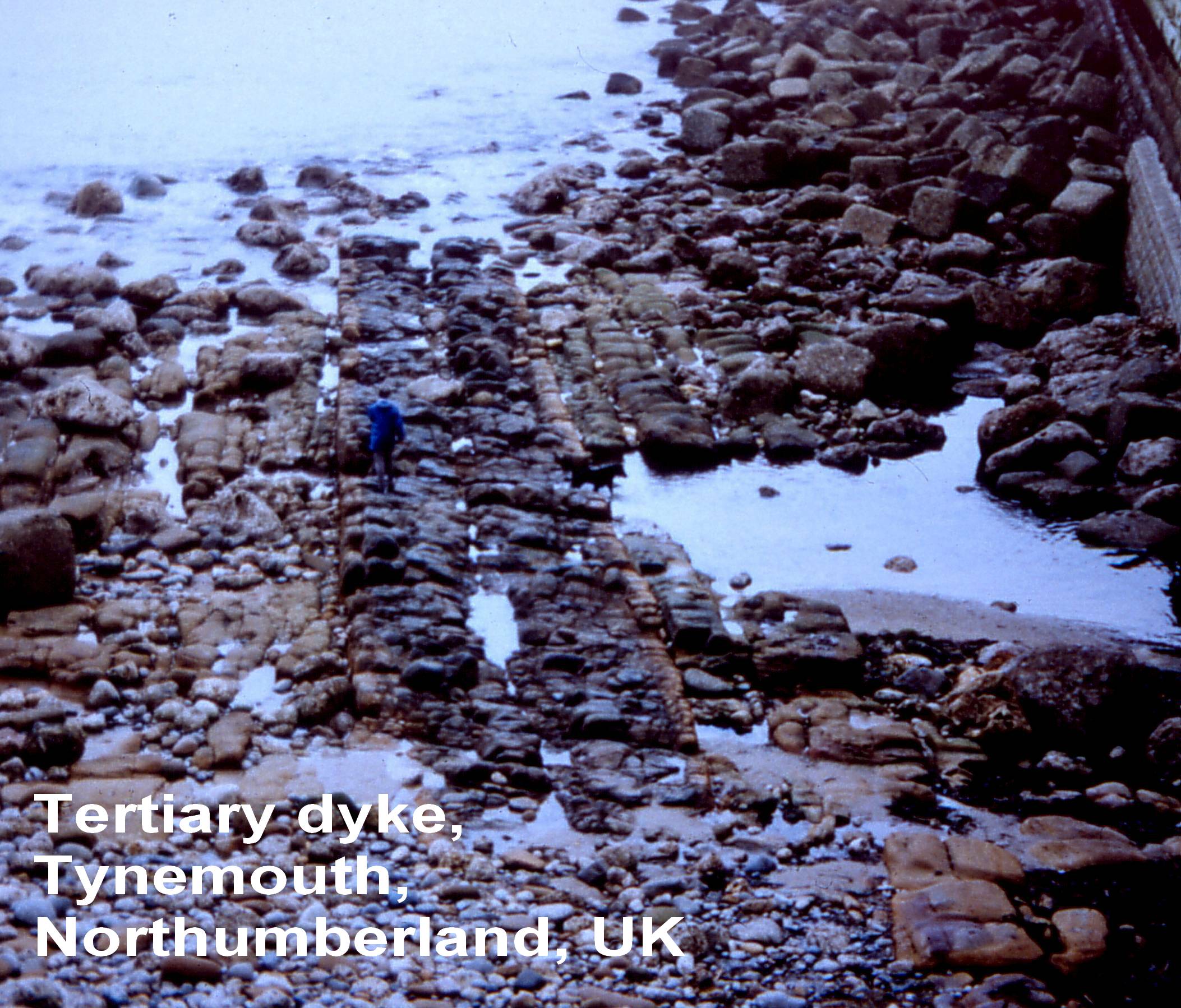
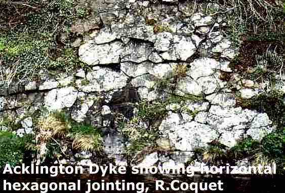
It was during this period of separation resulting in crustal tension
that a number of linear igneous rocks known as dykes, e.g. the Cleveland, Tynemouth and Acklington Dykes composed of a type of basalt, were intruded.
These are the only tertiary rocks to be seen in Northern England. The
Cleveland Dyke and the sites where it was quarried for roadstone
can be seen in several places, e.g. at Great Ayton, and at Castleton. In
fact, from the the vantage point of Roseberry
Topping the dyke, being a more resistant rock, can be seen to form a distinct
ridge running in a WNW-ESE direction. |
|||||||||
|
|
|
||||||||